Primary Functions
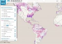
- The IWMI Water Data Portal (WDP), following the “one-stop shop” approach, provides access to a large amount of data related to water and agriculture. WDP contains meteorological, hydrological, socio-economic, spatial data layer, satellite images as well as hydrological model setups.
Detailed Description
The International Water Management Institute (IWMI) has been doing research on water for the last 30 years. Being a non-profit research organization all the research outputs and data used for the research are shared with researchers across the globe as global public goods (GPGs).
The IWMI Water Data Portal (WDP), following “one-stop shop” approach, provides access to a large amount of data related to water and agriculture. The IWMI Water Data Portal contains meteorological, hydrological, socio-economic, spatial data layer, satellite images as well as hydrological model setups. The data in the WDP, both spatial & non-spatial, are supported by the standardized metadata and are available for download by users including academia, scientists, researchers and decision makers. However, access is provided in compliance with copyrights, intellectual property rights and data agreements with our partners.
The portal is maintained by GIS, RS and Data Management (GRandD) Unit to facilitate sharing and reuse of data.
