statusEngagement
Showing all 17 results
-
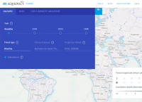
Aqueduct Floods (2020)
This tool measures and maps flood risks worldwide.
-
Automated Geospatial Watershed Assessment Tool (2018)
This tool is a GIS-based hydrologic modeling tool designed for both novice and expert GIS users.
-

Connecting the Drops Toward Creative Water Strategies
Use data from your facility to generate a broad assessment of risks regarding the local watershed, supply reliability, efficiency, compliance with regulations, supply economics, and social context.
-

Contextual Goals Database (2020)
This database contains leading sustainability goals and commitments set by large companies globally.
-
Drought Stress Testing Tool (2017)
The ‘Drought Stress Testing Tool’ allows financial institutions to see how incorporating drought scenarios changes the perception of risk in their own loan portfolios, based on the catastrophe modelling framework that the insurance industry has used for 25 years. The Excel-based tool is free to access and use but users must email for access.
-
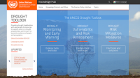
Drought Toolbox (2019)
The Drought Toolbox provides drought stakeholders with easy access to tools, case studies, and other resources to support the design of National Drought Policy Plan.
-
Groundwater Exchange (2018)
The Groundwater Exchange is an online resource center connecting water managers, water users, and community members with tools and resources to support the design and implementation of effective Groundwater Sustainability Plans under California’s Sustainable Groundwater Management Act.
-
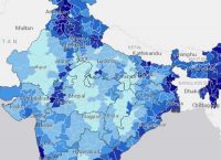
India Water Tool (2019)
The India Water Tool brings together 20 datasets and risk indicators to help users understand their water risks in India.
-

Indicators of Hydrologic Alteration (IHA) (2018)
Indicators of Hydrologic Alteration (IHA) is a software program that allows water resource managers, hydrologists, ecologists, researchers and policy makers to assess how rivers, lakes and groundwater basins have been affected by human activities over time – or to evaluate future water management scenarios.
-
Local Water Tool (2015)
Evaluate water-related external impacts, business risks and sufficiency of management plans at specific sites. Users register for free access to the tools with GEMI.
-
Managed Aquifer Recharge Portal (2018)
Managed aquifer recharge (MAR) represents a viable method for sustainable water management. This viewer provides a global overview of MAR suitability maps and MAR case studies and their relevant parameters.
-
Natural Capital Protocol (2019)
The Protocol offers a standardized framework for the identification, measurement, and valuation of impacts and dependencies on natural capital in order to inform organizational decisions.
-
Soil and Water Assessment Tool (2018)
This tool can be used to simulate the quality and quantity of surface and ground water and predict the environmental impact of land use, land management practices, and climate change.
-
Water Risk Filter Suite
The Water Risk Filter can be used to assess and respond to water related risks for your own operations, suppliers, or growth plans.
-
Watershed Ecosystem Service Tool (2018)
Explore how ecosystem services, land uses, and socioeconomic factors interact across Cambodia’s landscapes.
-
WATSCAN Tool for Water Planning and Assessment (2017)
WATSCAN is an integrated IT driven, GIS and Remote Sensing based information system that enables comprehensive watershed evaluation, aimed at devising community-centric water management interventions.
-

World Bank Open Data (2018)
World Bank databases are essential tools for supporting critical management decisions and providing key statistical information for Bank operational activities. This site is designed to make World Bank data easy to find, download, and use.